gis services / soloutions
Backed by decades of experience in cartography and mapping solutions, TTK Maps has now forayed into GIS segment solutions.
TTK Maps has been established as an information technology services company to provide Geospatial solutions, technical support services, web portal implementation, Project Management and data provider for various Applications including LBS.
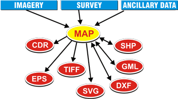
GIS Services
- Mapping Services
- Ground verification survey
- Geo-referencing/Geo-coding
- Geo data bases
- GIS Data Conversion
Solutions
- Transportation/Routings
- Telecom
- Utility
- Real Estate
- Retail/Distribution Network
- Banking
- Custom Programming
- Web integrated solutions
Customized Products/Projects.
Performing work for specific clients will be given at most importance by TTK Maps. We will strive for total customer satisfaction and quality by implementing best practices and solutions.
TTK Maps have developed various customized application using digital Maps for various clients and few of them are listed here:
- GLR Map (Parcel) developed for Government of India, Defense Department (63 locations across India).
- Complete Topography Map developed using QB Imagery to establish Eco Park at Chennai for Government of Tamilnadu .
- Complete Digital Map developed for for Cochin Port Trust, Mangalore Port Trust and Tuticorin Port Trust using high resolution satellite imageries to use these geo data base in Port Management System (I Pin)
- Decision Support system developed for India Post using open GIS using Chennai Data base.
- Cross section depth survey and Mapping for River Coovam and its environment for Chennai Public Works Departments
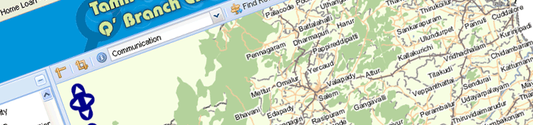
- Crime Analysis Map developed for Railway Police, Police Information system developed for Tamil Nadu Police “Q” Branch
- Air route maps and complete Air Port map of Chennai developed for Airport Authority of India
- Soil Classification Map developed for entire Country for National Bureau of Soil Survey.
- Feasibility study to lay railway track for a market participant.
- Web based GIS portal developed for a Petroleum Retail Major and a leading commercial vehicle manufacturer
- Worked on R-APDRP Project covering 25000 CKM Electrical Network and 12 Lakhs consumers in Two States.
- Emergency Mapping depicting the underground Pipe line along with its Topography for CPCL
- Mysuru Bus route Mapping developed to track online the Buses pertains to KSRTC